August 29, 2022
Platform release 5.4.02
Better rendering of network locations on map
A network location is a type of localization, only available for Sigfox trackers, acquired by knowing which antennas have received the Sigfox message. It has a low accuracy (typically several kilometers). Showing such network locations on a map is a bit tricky, because we need to avoid giving a false impression of accuracy.
We have improved some of the annoyances and confusing behavior.
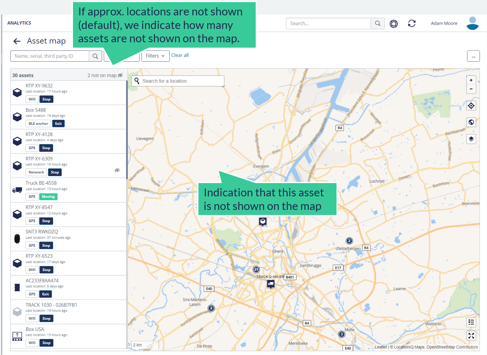
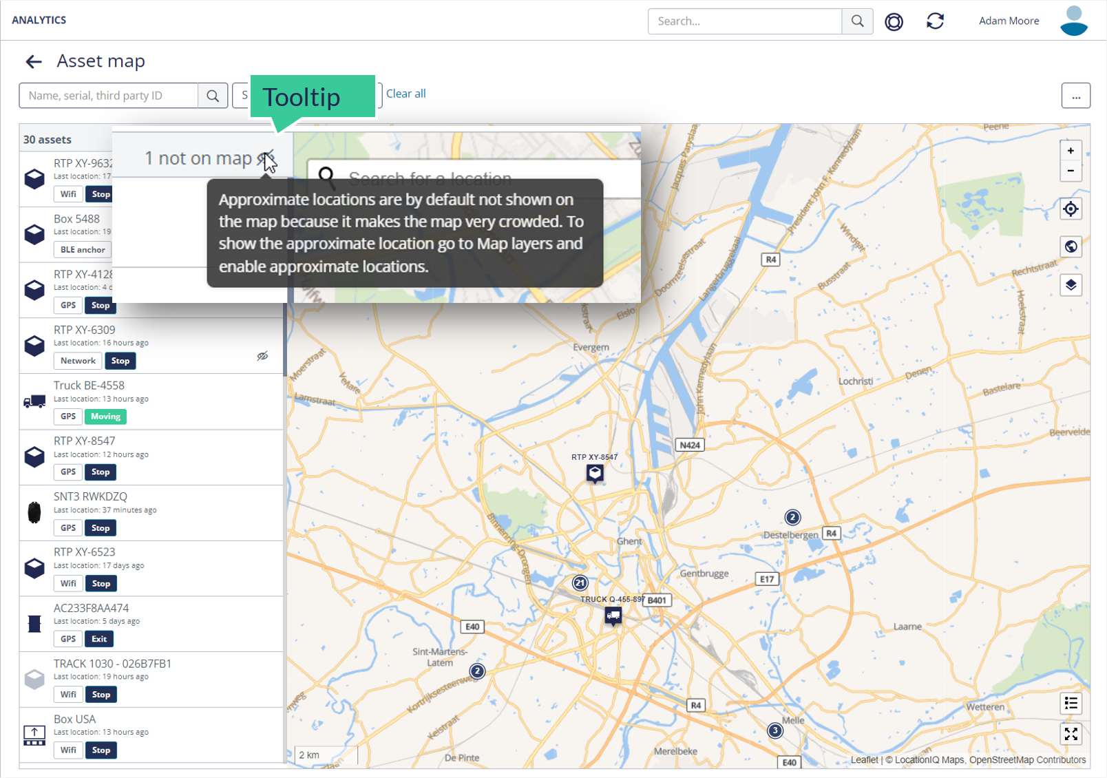
Previously, we should a warning that alarmed users. Now, a tool-tip is shown.
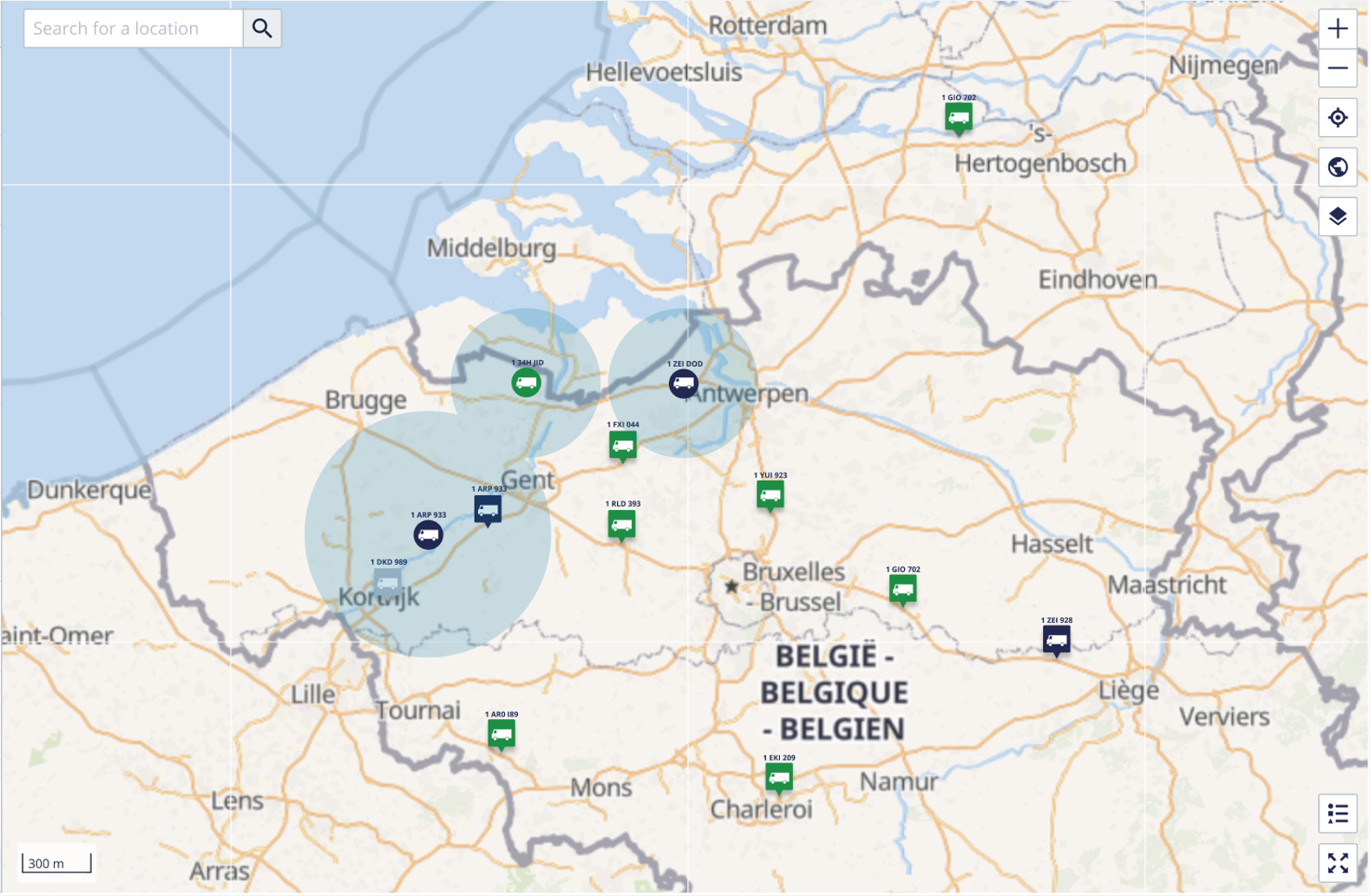
From now on, the asset name and icon are also rendered in the shaded circle that represents the network location. The icon of a network location is also round - contrasting with the square-with-pointer icon for more accurate localizations (GPS, Wi-Fi, etc...)
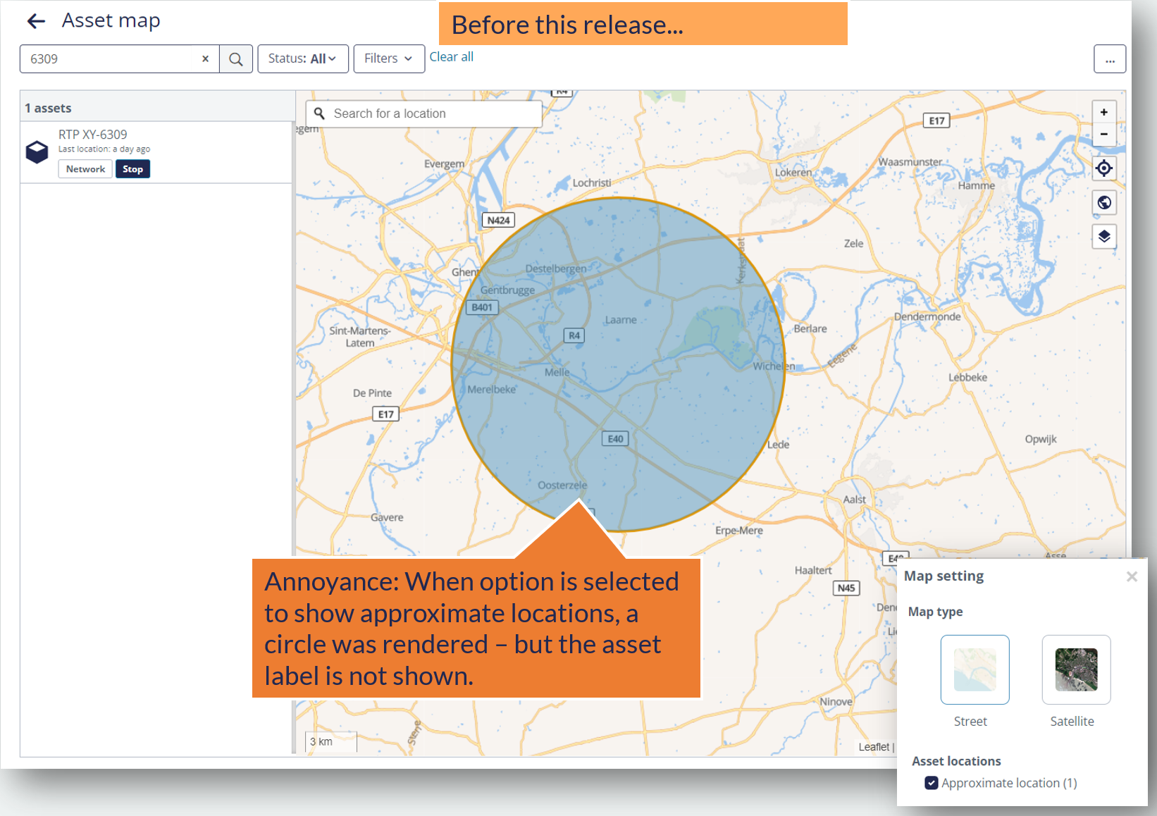
As a reminder: before this release, no asset icon was shown for network locations.
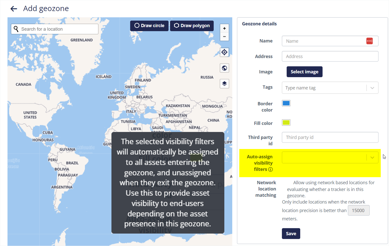
Clarified geozone auto-assign visibility filters
There was an already existing feature to automatically assign visibility filters to asset when it enters / exists a geozone. However, the label was confusing . The label has been improved, and a tool-tip has been added.
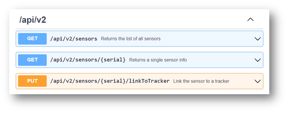
Link sensor to trackers using API
The API has been extended to include better access to Bluetooth Sensors. This has been added for customers that want to perform this configuration through their own systems or app.
- Get the list of sensors
- Get the details of a single sensor (by serial number)
- Link a sensor to a tracker.
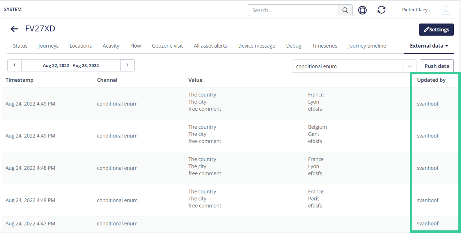
External business data improvements
From now on, the platform stores and shows the user who updated the custom business data. The column 'updated by' contains the username.
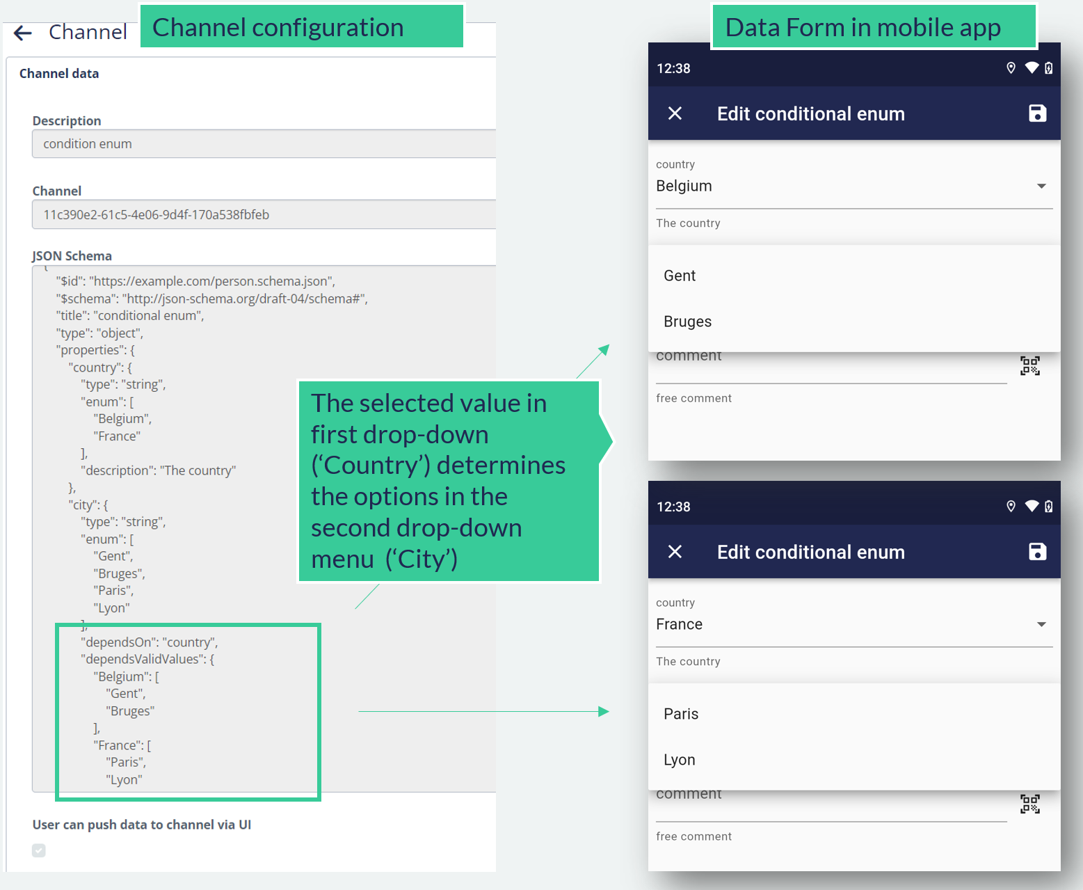
Also, you can now configure linked lists (drop-down menu selection) in the mobile form. For example, enable a user to first select a country and then select a city within that country.
Assign a tracker profile the using mobile app
It is now possible to edit the tracker configuration also with the mobile app (before, this was only supported in the Web Portal.